| From: |
BoardSec |
| To: |
Natasha Gocool |
| Cc: |
|
| Sent: |
2012-03-05 at 1:13 PM |
| Received: |
2012-03-05 at 1:13 PM |
| Subject: |
FW: OEB-2011-0394 Interrogatorries |
-----Original Message-----
From: beaudry, raymond [mailto:wrf@manitoulin.net]
Sent: March 2, 2012 4:43 PM
To: BoardSec
Cc: Michael Millar; Edik Zwarenstein; James C. Sidlofski NP Law; Erin Gordon Expositor; Gordon Potts NP; Art Jacko; wrf@manitoulin.net; tom.adams.energy@gmail.com; cbayne@bayniche-conservancy.ca; action@lsarc.ca; neoskwes@hotmail.com; gusland@amtelecom.net; cbell@amtelecom.net; johnnicolesmith@xplornet.com; kodaisl@rogers.com; jane.wilson@ripnet.com; parker.gallant@sympatico.ca; ashnee52@hotmail.com; Sarah Jane Turney CP; Neil M Smiley CP
Subject: Fwd: OEB-2011-0394 Interrogatorries
To Ms. Walli,
Please find attached questions for McLeans Mountain Wind Farm for its
application EB-2011-0394 filed on behalf of Manitoulin Coalition for Safe
Energy Alternatives, Lake Superior Action Research Community, Bayniche
Conservancy, Wikwemikong Elders, Community and Youth, and Manitoulin
Nature Club.
We will provide interrogatories as soon as possible on Exhibit G, Tab 1,
Schedule 2: Table of Lands Required for Transmission Facilities, provided
by the applicant pursuant to Procedural Order No. 3 on the afternoon of
March 2nd.
Reference: Exhibit B, Tab 1, Schedule 1
1.The application package pages are not numbered as per standard filing
practices. Please explain why pagination was not provided for the
prefile.
2.The application states that the Application is a limited partnership
between Northland Power Inc. (NPI) and with Mnidoo Mnising Power Limited
Partnership (MMP). Please explain this relationship including date the
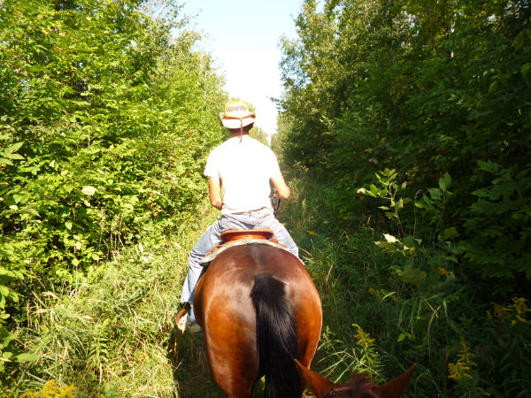
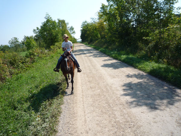
partnership was established, the roles of the respective partners.
3.We understand that should the transmission line, easement request and
REA be approved,that approximately $90 million funding is required to
complete this project. Is this correct and would the partnership dissolve
should the funding not be available? Assuming this application is
approved, would Northland Power be allowed to continue with the
transmission line and project without its partner?
4.Please clarify the role of MMP in all the components of the
transmission line project, including but not limited to land acquisition;
approvals; construction of switching, transformer stations, submarine
cable and all other elements; maintenance; and, decommissioning.
5.Please explain in detail the nature of MMP including its experience in
managing large electrical projects, its financial and operating resources
to complete the project, and its governance structure.
6. Who was the representative of each of the First Nations at the time
MMP was created and who represented each First Nation at the time of the
signing of the partnership agreement between MMP and NPI?
7.Please confirm that the term of office for chief and council of the
Whitefish River First Nation ended on January 7,2011 and that the
election of a new chief and council did not occur until February 12,2011.
Please indicate the position of the person who committed the Whitefish
River First Nation to MMP at the time this commitment was made.
8.Please clarify all relationships included in the statement MMPS
general partner is Mnidoo Mnising Power General Partner Inc. We note
that in paragraph one, MMP is referred to as Mnidoo Mnising Limited
Partnership. Does MMP have any other partners than its General Partner?
9.Please confirm that Aundeck Omni Kaning (AOK) First Nation, is one of
the named partners in MMP. Does the applicant acknowledge that AOK passed
a Band Council Resolution that opposes this project and related
transmission line? Does the applicant also acknowledge that AOK also
requested and received a 60 day extension to the REA process in order for
AOK to undertake more complete consultation with their community and that
this REA comment period extends until March 27,2012? Please explain in
detail and document the relationship of AOK with MMP.
10.Please explain why the applicant believes that the Board can consider
the application before the REA is complete.
11.Does the applicant acknowledge that the UCCMM Chiefs signed without
the approval of council and members where many oppose this transmission
line? Have all First Nation partner communities been allowed to fully
consult with their members? Please provide documentation on the
consultations that the applicant relies upon, including the dates,
agendas and minutes when community meetings have taken place.
12.Please provide support for the statement at B/T1/S1 para. 3 on how MMP
partnership would protect First Nations rights, Heritage and to ensure
the future for First Nations Youth. How is the transmission line
fulfilling this statement. What are the benefits quantified or otherwise?
13.The applicant makes this statement ,The MMWF Project falls within
the Traditional lands of the Anishinabe of Manitoulin. We agree with
this statement, though without clarification, this leaves one to believe
that this project is on First Nation Land. Does the appliant acknowledge
that the project is on Private land? Please clarify.
14.Being the traditional lands of the Anishanabe, Wikwemikong has
Anishanabe members. The elders, community members and youth group are
opposed to this application with over 600 signatures from this community
alone. There is also a possible unsettled shoreline marine allowance land
claim for the submarine cable crossing. Please explain in detail how the
applicant satisfied its onus to consult with Wikwemikong and address
their concerns.
15.The applicant makes this statement, This application is in respect
of
the transmission facilities associated with the MMWF project. Where
would one find the easement request as noted in the application? Is
documentation required for affected lands? Please provide lands required
for easements.
16.Please file any road use agreements that the applicants have with all
relevant authorities. Please provide details on all road use agreements
applied for but not yet received.
17.reference: Exhibit E Tab 1 Sch 5 The included line drawings show poles
72 and 73 not on the road allowance. Please confirm. This is inconsistent
with original drawings in this application and the statement in Ex B Tab
2 Sch 1 page 9, second paragraph. Please confirm and provide an
explanation of the locations proposed for poles 72 and 73.
18.Reference: Exhibit E Tab 1 Sch 5, Please supply descriptions of dead
end structures and any other framing that may not be included. What is
the framing at transmission pole 62 to maintain clearances above the
existing 44 kV line? Provide a complete drawing showing the position of
the 44 kV line.
19.Does the applicant acknowledge that the transmission line as proposed
would cross key habitats, including ANSI and known species at risk,
endangered, protected species habitat areas. Transmission lines are known
to cause high mortality rates among some avian species.
20.Does the applicant acknowledge that the proposed route includes area
of the Sheguiandah Burr Oak Savannah and known wetlands? Where are the
studies for the transmission line and submarine cable impacts to Flora,
Fauna species and SARS on the proposed route?
21.The MNR has previously disallowed disturbance of alvar habitat areas
on Harbourview Road. What are the mitigation plans for disturbances of
this habitat due to the transmission project?
22.Please supply maps that show the proposed project overlayed on
wetlands, all First Nation land as reference in NEMI tax roll ,
residences and businesses in relation to ROW and distances from conductor
swing, all First Nation road allowances, and any lands claim areas.
23.Please identify all elements of the proposed transmission line that
could impact official snowmobile trails. Indicate if notice was served on
the Ontario Federation of Snowmobile Clubs and the Manitoulin Snowdusters
Club. Please indicate any safety related signage planned for any elements
of the proposed transmission project that could impact safe use of
official trails.
24.The transmission line route crosses rural single phase and three phase
lines as well as running parallel and above. It also crosses two 44 kV
circuits . We have concerns over the induction impact, dirty electricity
in relation to sine wave irregularities and voltage levels on the these
lines and residents homes, excessive ground currents on Morphets side
road and other locations the transmission will be above or directly
beside the transformer or lines supplying the house or business. What
assurances is the applicant able to provide that the proposed
transmission line will not impact electrical service to local consumers?
25.What equipment or other mitigation is the applicant proposing to
protect local properties from over currents and trickle voltage related
to the project?
26.We have concerns with wireless communication along this route also.
There are several communication towers in this proximity including Bell,
local radio station transmitter, local ham operator club, hospital and
fire crew communication towers. Have the impacts to these locations been
considered? Please provide full documentation.
27.We have concerns with the proposed ROW and the fence lines along road
allowance and property lines. What criteria was used to determine
locations for land measurement for relevant fence line locations and road
allowance?
28.Will fence lines be moved to allow pole and line construction? What
are the plans for possible damage?
29.Residents in the proximity of the proposed transmission line have
concerns over the construction activity that will directly impact the
normal road use on roads. Concerns include; undue stress, affect on
residents with disabilities, construction noise, heavy equipment on road,
normal usage and enjoyment by residents and others, dust around houses,
dust on hay crop for horse use, contaminants from ground that could be
released, gas and oil pockets, disturbance of normal underground water
flows, possible rock drilling, property damage, use of our driveways for
turnarounds, regular mail delivery, domestic animal impacts, construction
extending beyond normal hours and weekends, continual use of this road
for other construction access, bird, bat and wildlife habitat impacts,
ditching, construction impact on well water due to pole depths, runoff,
oil spills, land restoration, visual impacts to this scenic road and
area, normal tourism and local traffic access, heavy rain runoff,
conductor stringing impacts, possible power outages on rural line, waste
material from tree and brush removal, stumpage left behind on site, fence
line disturbance, trespassing, and other impacts not readily identified.
What plans do the applicant have to address these direct impacts?
30.What assurances does the public have that all requirements of the
Occupational Health and Safety Act, Construction Safety Act, Highway
Traffic Act and all other related legislation will be followed in this
transmission line construction?
31.Please provide detailed maps showing proposed ROW and line clearances.
32.Part of the transmission line route proposed uses the North side of
Morphets side road where there are permanent residences. The
properties across from lots 3 and 4 conc 7 on the south side do not have
residents and the line route could continue east on this south side of
Morphets Side Road then cross and not have trees and hedgerows
between
the residences and the road removed. Please explain why the applicant
proposes to build on the north side of Morphets Side Road. What would
be
the implications of not building on the north side?
33.There are residents on both sides of Morphets sideroad on lots 2 of
conc 6 and 7. How does McLeans Mountain Wind Farm address the impacts
its project would impose on those properties?
34.What noise levels are associated with the equipment proposed and are
there any possible noise impacts to the neighbours in direct vicinity?
Please provide all relevant documentation.
35.The Morphets Side Road is used extensively for the tourists to
access
the McLeans Mountain lookout and is regularly featured in our local
paper for its beauty of fall colours. The residents, all horse owners,
ride horses up and down Morphets side road regularly. A transmission
line and tree removal is affecting qualities of life that many enjoy.
Manitoulin is a tourist based economy. What is Mcleans response to a
transmission line placed in a tourism based economy and known route to
McLeans Mountain Lookout?
36.Alternate routes were presented that directed the path of the proposed
transmission line along leaseholders properties that are participants in
the project. The applicant rejected these proposed alternatives and now
the route presented is affecting many non participants. The request is
affecting our land values and way of life. The now-rejected alternate
route would be shorter and would have used an existing Hydro road
allowance corridor along Hwy 540 along Willis side road beside existing
participating leaseholders land or along participating leaseholders
gravel pit that has access to HWY 540. There is also an abandoned
Hydro One 44 kv ROW that was once used in this area north of HWY 540. Why
should other non participating residents in the project be impacted by
this proposed route? Please explain in detail why any of these other two
routes were not chosen?
37.What other alternative routes for transmission were considered by
McLean and local input?
38.Please confirm on the record that no expropriation is required.
39.In reference to Exhibit K, tab 1, Sch 1, Number one. Application to
MNR has to be resubmitted once alignment for marine cable has been
finalized. Do all maps in this application show the final alignment?
40.If alignment is different than info supplied when would the public be
able to comment on this?
41.Please supply copies of all applications to the MNR and all other
relevant authorities in relation to Exhibit K, Tab 1, Sch 1.
42.The transition station at the submarine cable entry point appears to
be located in a cleared area and on barren rock with little overburden
directly in view of the North Channel boating route. What measures will
be taken to lessen the visual impacts of the facilities associated with
the submarine cable entry and exit?
43.Please resolve the inconsistency of drawing Ex. E/T1/S4 MM-01 entry
point into the North Channel with the line drawing in Ex E, Tab 1, Sch 5.
44.Reference Ex. E/T1/S4 MM-01 Is the Transition Station location on the
NEMI TWP road allowance? MM01 shows buried cable entering substation
station along shore line. Is this a correct depiction? Where does this
cable originate from?
45.Please provide the characteristics of the fenced off switching
substation on the Manitoulin side of the North Channel including land
rights, noise studies, fence height.
46. The North Channel was dredged years ago and, being limestone, has
ledges. The North Channel water flow has at times very high currents.
Sometimes these currents are from the east and other times from the west.
At times, the currents are strong enough to push navigation buoys
underwater. How is the submarine cable protected from abrasion?
47.What are the navigation impacts of the submarine cable? Submarine
cable lessens draft depth for ships accessing this route. Is maximum
draft for ships now required for this cable crossing to maintain
clearance from these cables? How will this be controlled or enforced? Is
there a possibility of anchors damaging the lines and what mitigation
measures are proposed. How will the applicant ensure that paper and
electronic marine charts will be accurately edited?
48.What measures are being taken to ensure that the submarine cable is
adequately protected from ice scour?
49.The submarine cable exit point trenching on Goat Island to the
connection /switching Station is near a known contaminated waste site.
This proposed trench could cause drainage from this site directly to the
North Channel. What measures will be taken to mitigate this possible
effect to known multiple fish species and not far from the Little Current
Water intake?
50.What protection systems are planned for the underwater cable? Please
provide all permissions sought and granted re; underwater cable including
but not limited to MNR, DFO, Transport Canada, any First Nation
involvement and any others.
51.What is the role of the fibre optic system associated with the
submarine cable?
52.What mechanical protection is provided on this fibre optic to prevent
damage and cause reliability issues along this ROW and in particular the
underwater portion?
53.How will rock stress points on fibre optic underwater be addressed?
54.The interconnection point with HONIs facilities seems to be
adjacent
to a HONI three pole heavy angle 115 kv structure with guying? Is this
where the connection point will be? What framing will be required from
this structure if so? If this 3 pole structure is not available for use
will HONI be required to install another structure ? What are the HONI
requirements for connection to this station?
55.What are the noise impacts to the area around the Connection/Switching
Station? This is across the North Channel from prime real estate. Please
provide the noise studies, noise from switching actions for this station
and the impacts on the homes on the south side of the North Channel.
56.How will the proposed transmission line impact real estate value
proximate to the line on the south side of the North Channel?
57.At part lot 21 conc 12 , a section of this property is currently for
sale as prime water front real estate. The land has development potential
due to its location. The land is listed with a local realtor. Are the
landowners aware of the trenching and switching station plans? Have they
been notified? Are there easement plans here? We request details of non
confidential land matters be supplied and a more detailed map of the
115kv line leaving Harbour view road including property lines, road
allowance, transition substation, marine allowances, sub cable route and
entry point to North Channel. We have concerns on the effects to tourism
and the cruise ships that travel here to support the local economy.
58.Please provide details of the applicants notice provided to
waterfront owners and seasonal residents?
59.Reference: B/T1/S1 para 7: The evidence references site work dates
that do not correspond with the Summary Schedule in Exhibit C Tab 4
Schedule 2.Please clarify this inconsistency.
60.Please provide a detailed breakdown of proposed construction schedule
in Exhibit F.
61.Given that this project has been in the works since 2004, why did the
applicant wait until November 22, 2011 to file its application? When did
the applicant apply for its FIT contract and when was the contract
granted?
62.Reference: B/T1/S1 para. 6c: This section provides a description of
the proposed transmission facilities but does not mention the switching
substation at the sub cable entry point. Particularly in light of the
significance of the required water front land usage, why was this not be
included?
63.Reference Exhibit C Tab 4 Schedule 1: This reference states that the
site work is to begin in the Winter 2011. How is this evidence consistent
with the applicant only filing its case with the Board in November 2011?
Please provide updated dates. Please update the GNATT chart provided in
C/T4/S2.
64.Have land leases been secured for all pole anchoring , guying and sub
cable trenches, switching devices, entry and exit points for the
submarine cable route, and conductor crossings over private property?
65.The map in Exhibit B, Tab 2, Sch 1 shows a different route and
generator location in relation to route as compared with Exhibit I, Tab
1, Sch 4. Please resolve this inconsistency.
66.We have reliability concerns related to proper setbacks of wind
generators in the close proximity of the transmission line. Hydro One has
setbacks of 500 metres for system reliability. Please supply distances of
generators from transmission line. How will ice throw, blade failure or
turbine collapse be addressed in relation to transmission line impacts?
67.Reference Ex E, Tab 1, Sch 4 - Please revise the first drawing (MM01)
so that fenced areas are properly shown including tarping, contaminated
soil, drainage systems, leachate management systems and all other
relevant land characteristics.
68.Please provide the presentation slides from the the August 4 2009
meeting where Northland Power president John Brace spoke to NEMI council.
69.Please confirm that the REA Reports, including complete transmission
information, were available at all MMP community locations.
70.Please provide detailed layout drawings do scale showing the proposed
transmission line and anchoring showing; driveways, fence lines, road
allowances, property lines, pole placements, anchor and anchor pole
placements, cable trenching, telephone and cable lines, property
designation, single phase and three phase rural lines and clearances, 44
kV circuits and clearances, marine allowance, culverts, wetlands, wetland
crossings, ditches, natural and man made drains, existing OFSC snow
machine trail use in ROW and road allowances, all fenced in stations and
anything significant in the area including houses & buildings, NEMI arena
and parking lot, vacant lots, fully fenced in contaminated waste material
on Goat Island and location of station in relation to connection point to
HONI transmission line.
71.Reference Exhibit B, Tab 2, Schedule 1 Section 1.3.2 The evidence
states that the Project location is approximately 5 km from the Town
of
Little Current. Please define the use of the phrase Project
location.
Please confirm that the transmission line, which is the subject of this
application, goes through the Town of Little Current.
If you require clarification on any of these questions, please do not
hesitate to contact me.
Thank you,
Raymond Beaudry
.JPG)